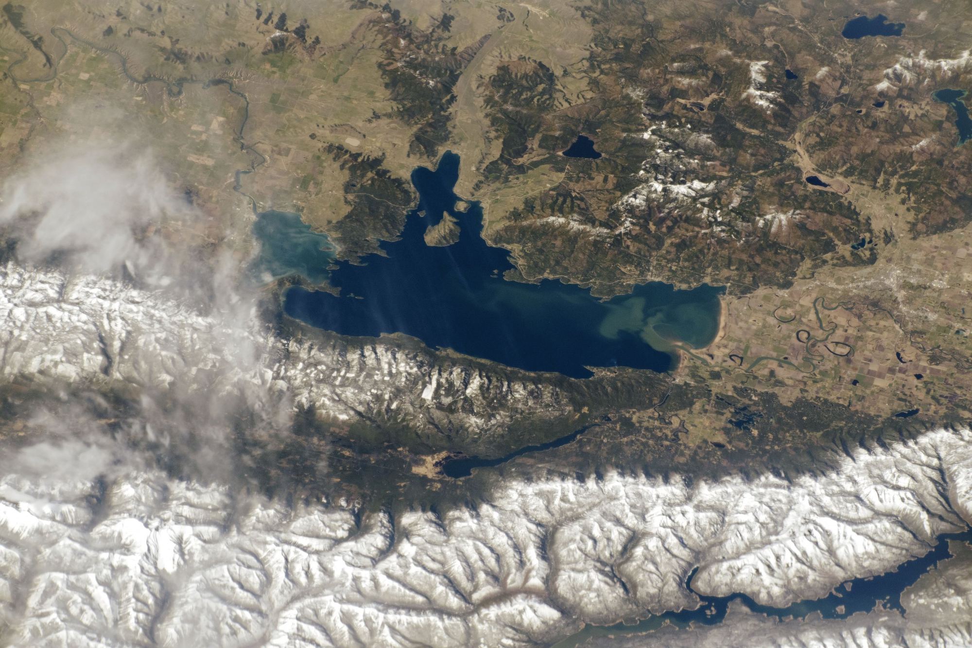
NASA astronauts photograph Earth from the International Space Station as part of an ongoing program called Crew Earth Observations, using handheld cameras through the station's windows rather than a fixed, north-up mapping satellite.
That's why this particular photograph — cataloged as ISS059-E-36857 — isn't oriented the way a road map would be: north points to the right, simply because of the station's position when the shot was taken, not because of any processing choice.
At roughly 190 square miles of surface and about 27 miles from its north end to its south end, Flathead Lake is the largest natural freshwater lake in the western United States, and this image is one of the clearest public views of the whole thing at once — every bay, peninsula, and the island in the middle, in a single frame no ground-level photo could match.
The seven markers on the map correspond to the real places named throughout this site's guides: the towns that ring the shoreline, the river mouth where the Flathead enters at the north end, and Wild Horse Island sitting roughly in the middle of the lake's widest stretch. Tapping one swaps in a short note about that spot and links straight to the guide that covers it, so the map works as a starting point for planning rather than just a picture to look at.