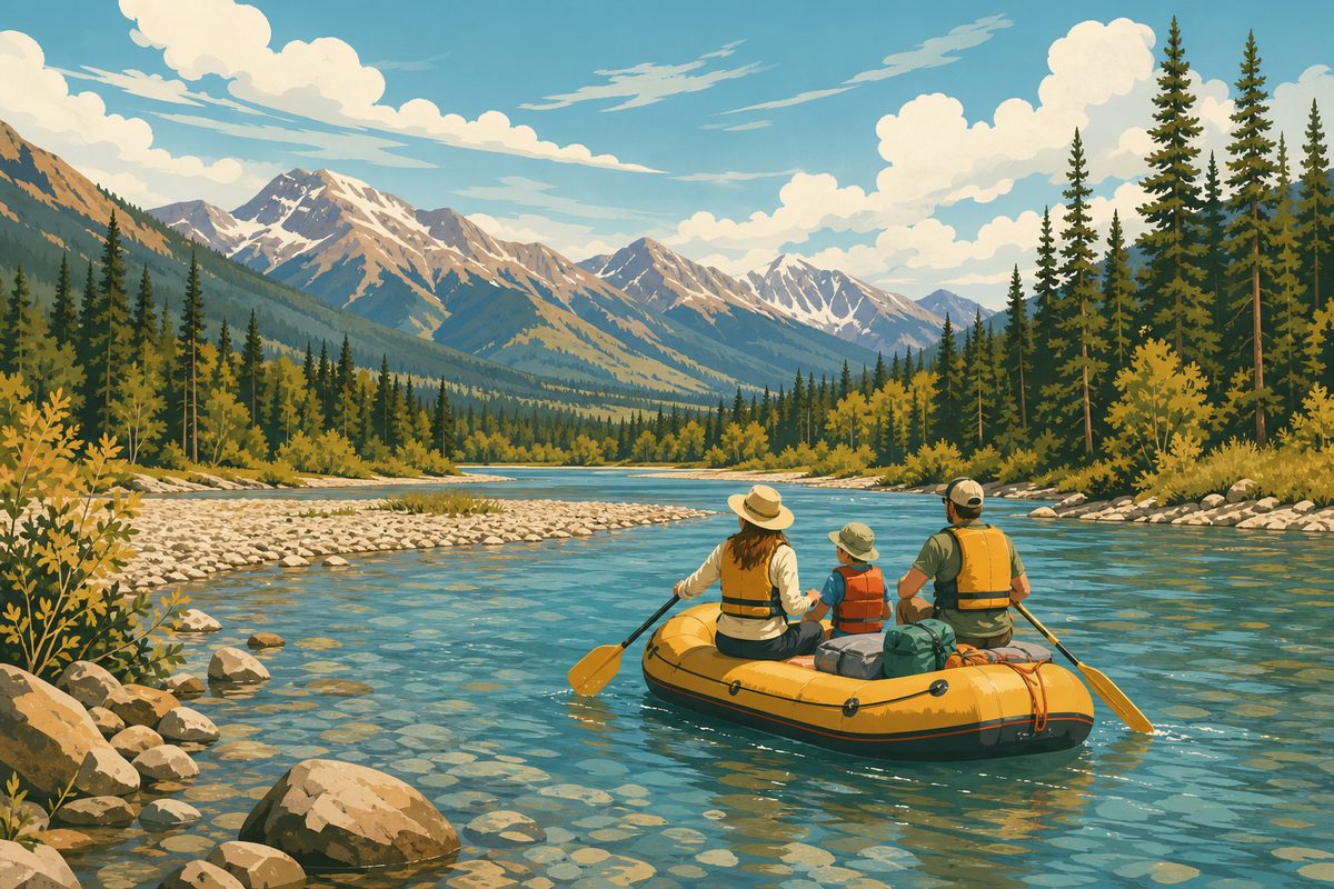
The Flathead River system carries two very different rafting experiences under one name. Upstream, where the Middle Fork threads along the southern and western edge of Glacier National Park, the river drops through a stretch of continuous whitewater known as John Stevens Canyon — the trip most people picture when they hear “Flathead River rafting.” Downstream, below Kerr Dam near Polson, the Lower Flathead spreads out into a bigger, calmer river that runs through the Flathead Indian Reservation. Both are part of the same watershed and the same broad Montana rafting season, but they ask different things of a first-time visitor.
This guide covers what each stretch is actually like, how the whitewater changes through the season, what a first-timer needs to know before booking a trip, and the access and permit questions — including tribal jurisdiction on the lower river — that are easy to overlook when you’re only looking at photos of big waves.
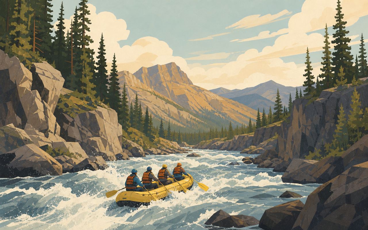
The river’s geography, in brief
The Middle Fork of the Flathead is roughly 92 miles long, rising deep in the Bob Marshall Wilderness Complex and flowing for much of its length as the boundary between Glacier National Park to the north and the Great Bear Wilderness to the south. For most of that run it’s remote, roadless water accessible only by trail or by multi-day wilderness float — a different proposition entirely from the day-trip whitewater covered in this guide. It’s only in its lower miles, as the river approaches West Glacier and picks up U.S. Highway 2 and the Amtrak line running alongside it, that it becomes the road-accessible canyon run most visitors mean when they talk about “rafting the Flathead.”
Downstream of West Glacier, the Middle Fork joins the North Fork and South Fork to form the main stem of the Flathead River, which flows on into Flathead Lake — the largest natural freshwater lake in the western United States. The lake, in turn, drains out at its southern end near Polson into the Lower Flathead River, which runs through Kerr Dam and on through the Flathead Indian Reservation before eventually joining the Clark Fork River. So while John Stevens Canyon and the Lower Flathead below Kerr Dam feel like two unrelated rivers, they’re two ends of the same continuous system, with Flathead Lake sitting between them.
The Middle Fork’s status as a federally designated Wild and Scenic River dates to 1976, one of the original rivers protected under that program, and the designation runs from its headwaters down to its confluence with the North Fork. That protection is a large part of why the canyon still reads as wild, forested, and undeveloped, even though a highway runs along one bank of the whitewater section.
The two stretches: John Stevens Canyon and the Lower Flathead
John Stevens Canyon, Middle Fork
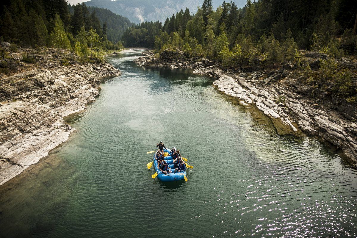
John Stevens Canyon sits on the Middle Fork of the Flathead River just upstream of the town of West Glacier, roughly paralleling U.S. Highway 2 as the river cuts through a narrow, forested canyon. This is the section almost every commercial day trip out of West Glacier is built around, and it’s the closest thing the Flathead system has to a signature whitewater run.
The canyon carries a series of named rapids that step down in relatively quick succession rather than one long continuous read of moving water. Most of the run sits in the Class II to Class III range — enough to require real paddling and a guide who knows the lines, but well within reach of a fit first-timer on a guided trip. One rapid in the canyon is harder than the rest and gets rated up toward Class IV when spring flows are running high, easing back down as the water drops through the summer. Outfitters generally treat that rapid differently from the rest of the run, and some let clients choose whether to portage around it depending on water level and group comfort.
Because the canyon parallels the highway and the Amtrak line on the opposite bank, it’s also one of the more accessible whitewater stretches in this part of Montana — put-ins and take-outs are a short drive from West Glacier rather than requiring a long shuttle into the backcountry. The river’s proximity to Glacier National Park’s boundary means the canyon run also delivers genuine mountain scenery: forested slopes, exposed rock, and glimpses of peaks inside the park, alongside the rapids themselves.
The Lower Flathead, below Kerr Dam
Roughly forty river miles downstream, past Flathead Lake, the character of the river changes completely. Below Kerr Dam near Polson, the Lower Flathead becomes a much bigger-volume river flowing through open valley country rather than a tight canyon. Flows here are influenced by dam operations as well as by the season, but in general this stretch reads as a calmer, more continuous river than the technical, rapid-after-rapid canyon upstream. It still moves — and can push hard at certain flows — but it doesn’t demand the same technical whitewater skill from a guide or the same level of nerve from a paddler.
The Lower Flathead is also geographically and administratively distinct from the upper river in an important way: it flows entirely through the Flathead Indian Reservation, home of the Confederated Salish and Kootenai Tribes (CSKT). That distinction matters for anyone planning to float or fish this stretch — see the access section below.
Between the two, a visitor choosing where to spend a day on the water is really choosing between two different rivers: a tight, technical whitewater canyon close to Glacier’s boundary, or a wider, calmer stretch of river below the lake, on land governed by the Salish and Kootenai Tribes.
What a day on the water actually looks like
Commercial trips through John Stevens Canyon typically run as half-day or full-day outings, with the exact length, put-in, and take-out varying by outfitter and by water level. A typical trip starts with a safety briefing on shore — how to hold a paddle, how to brace inside the raft, what to do if you go for a swim — before the group launches into a first stretch of flatter water that gives everyone a chance to settle in before the named rapids start. The rapids themselves come in a fairly quick sequence rather than being spread evenly across many miles, so a canyon trip tends to feel more continuously active than a long, lazy float.
Between rapids there’s usually calmer water where the guide slows the pace, points out canyon walls, wildlife, or a view back toward the park, and lets the group catch its breath. Full-day trips typically include a stop on a gravel bar or riverside spot for lunch. Because the canyon run is a genuine physical activity — paddling on command, bracing through waves, occasionally getting knocked around in a bigger rapid — it asks more of a participant than a scenic float does, though it doesn’t require athletic fitness, just a reasonable level of mobility and the ability to follow instructions under some excitement.
When to go: how the season changes the water
Flow on both stretches follows the same broad Rocky Mountain pattern, driven by snowpack rather than rainfall. Snow accumulated over the winter in the surrounding mountains melts through spring and early summer, and that melt is what fills the river. As a general rule, the highest, pushiest water on the Middle Fork shows up during the spring runoff window — typically sometime between late May and late June, though the exact timing shifts year to year with how much snow fell and how quickly it melts.
During peak runoff, John Stevens Canyon runs at its biggest and coldest: rapids are more powerful, the optional Class IV rapid is closer to its hardest rating, and the margin for error narrows. This is the window experienced paddlers often seek out specifically for bigger water, but it’s a tougher entry point for someone rafting for the first time.
As the season moves into midsummer, snowmelt tapers and flows drop to friendlier levels. This is generally considered the more approachable window for a first-time rafter — the same rapids are still there, but they’re less powerful and more forgiving, and the water, while still cold by comparison to the air temperature, is a little less bracing than peak runoff. By late summer, flows on the Middle Fork can drop quite low, and some of the smaller rapids in the canyon lose much of their whitewater character, shifting the trip’s appeal more toward scenery than big water.
The Lower Flathead follows a broadly similar seasonal rhythm but is additionally shaped by water management at Kerr Dam, so its flow doesn’t track snowmelt as directly as the free-flowing Middle Fork does. Because conditions vary from year to year and week to week, current river-flow information and direct advice from a licensed outfitter are worth more than any fixed calendar date when you’re picking a trip window.
Weather is worth planning around separately from water level. Northwest Montana summers bring warm, often hot afternoons in the valley, but mountain weather near Glacier can shift quickly, and afternoon thunderstorms are a regular feature of the season. A sunny morning launch doesn’t guarantee a sunny afternoon take-out, which is one more reason layered, quick-drying clothing works better than a single warm-weather outfit.
Safety and what to bring
Cold water is the single biggest safety factor on both stretches of the Flathead. Even at the height of summer, the river is fed by snowmelt and mountain runoff, and water temperatures stay well below what most people expect from a warm, sunny day. Dress for the water, not the air: quick-drying synthetic or wool layers rather than cotton, a swimsuit or rash guard underneath, and a jacket or splash top if the day is cool or overcast. Bring a full change of dry clothes and closed-toe shoes to leave in the vehicle for after the trip.
A properly fitted personal flotation device (life jacket) is standard equipment on any commercial trip and should be worn snugly, not loosely clipped. Helmets are typically required for the whitewater sections of the canyon. Guides brief every group before launching on what to do if someone ends up in the water — generally, float on your back with feet pointed downstream to fend off rocks, and let the guide or a throw rope bring you back to the raft rather than trying to swim hard against the current.
Sun exposure is easy to underestimate on the water, where glare off the surface adds to direct sun. Sunglasses with a retaining strap, a hat that won’t blow off, and reapplied sunscreen are worth planning for even on a cool or partly cloudy day. A dry bag or waterproof case for a phone or camera is a simple addition that avoids a common trip-ending mistake.
Several licensed outfitters run guided trips through John Stevens Canyon, permitted by the U.S. Forest Service, and supply the core safety and paddling equipment — life jackets, helmets where needed, paddles, and a trained guide who reads the rapids. If you’re renting gear to run a stretch independently rather than booking a guided trip, confirm with the rental outfit what’s included and get a current read on flow conditions before you go; whitewater that a guide runs routinely can be a different proposition for an unguided group without recent local knowledge.
Swimming ability deserves an honest conversation before you book. A life jacket keeps a non-swimmer afloat, but it doesn’t replace the comfort and self-rescue instinct that a confident swimmer brings to a rapid, and cold water saps strength and coordination faster than most people expect. If anyone in your group is a weak or nervous swimmer, say so when you book — a guide would rather match your group to the right water level and stretch of river than sort it out mid-rapid. Group size and boat assignments are also worth asking about directly, since a smaller, more attentive group can matter as much as the water level itself for a nervous first-timer.
Access, permits, and tribal jurisdiction on the lower river
The upper sections of the Middle Fork run along the boundary of Glacier National Park and through U.S. Forest Service land, and this corridor is managed under a river management framework that governs put-ins, take-outs, and commercial use. Licensed outfitters running trips through John Stevens Canyon operate under permits issued by the Forest Service. Private boaters planning to launch their own gear rather than book a guided trip should check current access points and any registration requirements with the Forest Service and the park directly, since these details can change season to season.
The Middle Fork also carries a federal Wild and Scenic River designation, a status intended to protect its free-flowing character and the outstanding natural, scenic, and recreational values of the corridor. That designation is part of why the canyon still feels remote and undeveloped even though it sits close to a major highway and draws a steady stream of summer visitors.
The Lower Flathead is a different jurisdiction entirely. Below Kerr Dam, the river flows through the Flathead Indian Reservation, the homeland of the Confederated Salish and Kootenai Tribes (Bitterroot Salish, Kootenai, and Pend d’Oreille). Kerr Dam itself — renamed the Séliš Ksanka Ql̓ispé Dam — has been tribally owned and operated since CSKT purchased it from the previous utility operator. Recreation on the reservation portion of the river, including floating and fishing, falls under CSKT jurisdiction rather than state or federal management. Anyone planning to raft, float, or fish the Lower Flathead should contact CSKT Fish, Wildlife, Recreation & Conservation directly ahead of a visit to confirm current permit requirements, access points, and any seasonal restrictions, rather than assuming state fishing or boating rules carry over onto reservation waters.
One more access requirement applies statewide, regardless of which stretch of the Flathead you’re on: Montana requires watercraft — rafts, kayaks, canoes, and other paddle craft included — to stop at open aquatic invasive species inspection stations, and boats arriving from outside the state generally need an inspection before they can launch on Montana waters. Nonresidents launching their own watercraft in Montana also need to purchase the state’s aquatic invasive species prevention pass. Because station locations, hours, and specific rules are updated regularly, check Montana Fish, Wildlife & Parks’ current guidance before hauling a raft, kayak, or drift boat into the state.
Fitting whitewater into a broader Flathead trip
Whitewater rafting is one specific, higher-intensity slice of what the wider Flathead system offers, and it isn’t the only way to spend time on this water. For families, younger kids, or anyone who wants the scenery and the feel of the river without technical rapids, gentler scenic float trips run on calmer sections of the watershed, moving at an unhurried pace past much of the same mountain and forest landscape. These floats are a natural alternative — or a complementary second day — for a group that isn’t all on board with Class III whitewater.
At the other end of the spectrum, some visitors extend a single day of rafting into a longer, multi-day trip that also takes in Flathead Lake, the Lower Flathead, and other parts of the region, turning one whitewater run into the centerpiece of a broader Montana itinerary. Because lodging and outfitter availability near Glacier tend to book up well ahead of the summer season, it’s worth working out the logistics of a longer trip early rather than as an afterthought.
However you build the itinerary, the two stretches covered here — the technical, scenic drop of John Stevens Canyon on the Middle Fork, and the bigger, calmer water of the Lower Flathead below Kerr Dam on the Flathead Indian Reservation — represent the range of whitewater the Flathead River offers, from a fast-paced day of rapids to a wider, more relaxed run through open valley country.
The Best Flathead River Whitewater Rafting Montana Guide, Quick Facts
Quick facts for anyone comparing whitewater rafting Montana options against other states: this whitewater rafting Montana guide sticks to one real river system, the Flathead, rather than generic advice. For the classic flathead river whitewater rafting run, John Stevens Canyon near West Glacier is what locals mean, and it’s also the stretch people are usually picturing when they search for whitewater rafting near Flathead Lake itself, even though the canyon sits well upstream of the lake. If you want the best flathead river trip for a first-timer, a guided half-day through that canyon beats attempting the full run solo. Between the Middle Fork’s Class II–III water above West Glacier and the calmer Lower Flathead below Kerr Dam, this whitewater rafting Montana guide keeps pointing back to the same two stretches — because those are genuinely the two that matter for most visitors, and the flathead river whitewater rafting community rarely recommends much else nearby. Anyone who searched specifically for whitewater rafting near Flathead Lake and landed here should read the John Stevens Canyon section first — it’s the closest real whitewater to the lake itself, even though it’s a drive upstream to reach it.
Frequently asked questions
Is whitewater rafting on the Flathead River suitable for beginners?
The standard day trip through John Stevens Canyon on the Middle Fork runs Class II–III rapids, which is a reasonable entry point for a first-timer who is reasonably fit and comfortable getting wet and cold. Guided trips put you with a professional oarsman or guide who reads the water and gives paddle commands, so you don't need prior rafting experience. If you want a gentler introduction to moving water, a scenic float trip on a calmer reach is a better starting point than the canyon.
What is John Stevens Canyon?
John Stevens Canyon is the whitewater stretch of the Middle Fork of the Flathead River just upstream of West Glacier, roughly paralleling U.S. Highway 2. It's the most heavily run whitewater section on the river, with a series of named rapids that vary from Class II riffles to a harder Class III–IV rapid at higher water, and it's the section most guided day trips are built around.
How difficult are the rapids in John Stevens Canyon?
Most of the canyon runs Class II to Class III, which means continuous but manageable waves, some technical maneuvering, and a few bigger, punchier drops. One rapid in the canyon is harder and gets rated up toward Class IV during high spring flows, dropping back down as the season goes on. Outfitters typically flag which rapids are optional to run and which the whole group commits to as a unit.
When is the best time of year to go whitewater rafting on the Flathead?
Spring snowmelt, typically running from late May through June, produces the highest and pushiest water, which is exciting but also colder and less forgiving for a first-time rafter. By midsummer, flows drop and the same rapids become friendlier and more predictable, which is why many outfitters and guidebooks point first-timers toward July. By late summer the Middle Fork can run quite low, and some rapids lose most of their punch.
Do I need previous rafting experience to book a trip?
No. Guided commercial trips are built for people with no whitewater background — the guide runs the boat, sets the line through rapids, and gives simple paddle instructions before and during the trip. What matters more than experience is being reasonably fit, willing to follow instructions in a moving raft, and prepared for cold water.
Is there a minimum age for whitewater rafting trips?
Age minimums vary by outfitter and by how high the water is running that season, since a harder, higher-water trip calls for a stronger swimmer and a calmer temperament than a mellow midsummer run. Many outfitters set a higher minimum age for the whitewater section of the Middle Fork than they do for a gentler scenic float. Check directly with a licensed outfitter for their current age policy before booking, especially if you're planning a family trip.
What should I bring on a whitewater rafting trip?
Bring quick-drying synthetic layers rather than cotton, a swimsuit or rash guard to wear underneath, and a change of dry clothes and shoes to leave in the vehicle. Sun protection matters even on a cool day — sunglasses with a strap, sunscreen, and a hat that will stay on. Most outfitters supply the life jacket, helmet where required, and paddle, but it's worth confirming what's provided and what you need to bring yourself.
Will I get wet and cold on the river?
Yes. Even in midsummer, water coming off mountain snowpack stays cold, and you should expect to get splashed regularly and possibly fall in if a rapid catches the boat wrong. Guides brief every trip on what to do if you end up in the water — float on your back, feet downstream, and let the guide or a throw rope bring you back to the boat. Dressing for the water temperature, not the air temperature, is the single biggest comfort factor.
What happens if the river is running too high or too low to raft safely?
During unusually high spring flows, outfitters sometimes shorten a run, skip an optional rapid, or pause commercial trips on the hardest section until the water drops to a manageable level. In a low-water year, especially by late summer, some rapids in the canyon lose most of their whitewater character and trips lean more on scenery than big waves. Outfitters and river-gauge data are the best source for current conditions before you commit to a date.
Do I need a permit to raft the Flathead River myself?
Sections of the Middle Fork that run along Glacier National Park's boundary and through U.S. Forest Service land are managed under a river corridor management plan, and private boaters should check current put-in, take-out, and any float-plan or self-registration requirements with the Forest Service and the park before launching on their own. Licensed commercial outfitters operate under permits issued by the Forest Service, which is one reason many first-time visitors book a guided trip rather than sourcing their own gear and running the canyon independently.
Can I raft the Lower Flathead River below Kerr Dam without a guide?
The Lower Flathead below Kerr Dam flows through the Flathead Indian Reservation, which is under the jurisdiction of the Confederated Salish and Kootenai Tribes (CSKT), not the state or federal agencies that manage the upper river. Anyone planning to float, fish, or otherwise recreate on this stretch should contact CSKT Fish, Wildlife, Recreation & Conservation directly for current permit, access, and tribal recreation-permit requirements before launching, since rules differ from state-managed waters.
What is the Lower Flathead River like compared to the Middle Fork canyon?
The Lower Flathead below Kerr Dam is a different character of river than John Stevens Canyon — bigger volume, wide open valley scenery, and generally calmer, more continuous current rather than the tighter, rapid-fire whitewater of the canyon. It's a reasonable option for paddlers who want moving water and some rapids without committing to the Middle Fork's harder drops, though conditions and releases from the dam can still create pushy water at times.
Do I need my own raft and gear, or can I rent equipment?
You don't need to own a raft to run either stretch of the river. Several licensed outfitters based near West Glacier run guided trips with all whitewater equipment supplied, and gear rental options exist locally for paddlers who want to run a stretch on their own with their own group. Renting from a local outfit also means picking up current, on-the-ground advice about flows and conditions rather than relying on general information alone.
Are there gentler float trip options if whitewater sounds too intense?
Yes. Sections of the Flathead system away from John Stevens Canyon offer calmer scenic floats suited to families, older kids, and anyone who wants to be on the river without technical rapids. These float trips cover some of the same broader landscape — mountain views, clear water, forested banks — at a slower, more relaxed pace.
Can whitewater rafting be combined into a longer, multi-day trip?
Yes. Some visitors pair a day of whitewater on the Middle Fork with additional days exploring Flathead Lake, the Lower Flathead, or other parts of the watershed, turning a single rafting trip into a broader multi-day Montana itinerary. Planning logistics and lodging around a multi-day trip is worth doing well ahead of a summer visit, since accommodation near Glacier fills up quickly in peak season.
What is a Wild and Scenic River designation, and does it affect rafting here?
The Middle Fork of the Flathead is a federally designated Wild and Scenic River, a status meant to protect its free-flowing character and outstanding natural values. In practice, this means the corridor is managed to limit development and preserve its wild condition, which is part of why the canyon still feels remote and undeveloped despite being a popular rafting destination just off the highway.
Do I have to stop for boat inspections when bringing a raft or kayak into Montana?
Yes. Montana requires watercraft — including rafts, kayaks, and other paddle craft — to stop at open aquatic invasive species inspection stations, and boats coming from outside Montana generally need an inspection before launching on state waters. Nonresidents launching in Montana also need to purchase the required AIS prevention pass. Requirements and station locations can change season to season, so check Montana Fish, Wildlife & Parks directly before you travel with your own gear.
Is whitewater rafting the Flathead safe for non-swimmers?
A properly fitted life jacket is mandatory on guided trips and does most of the work of keeping you afloat, but non-swimmers take on real added risk in moving water and cold-water rapids, and most outfitters will say so directly. If you or someone in your group can't swim, say so when booking — a guide can advise on which stretch and which water level is the more realistic and safer choice, or suggest a calmer float instead of whitewater.